









What are Judea and Samaria, and where did “West Bank” come from?
Judea and Samaria is the ancient name for the hills most media call the West Bank, a label from Jordan's rule. History, Oslo areas, and why names matter.
Key takeaways
- Judea and Samaria is the biblical and British Mandate-era name for the highland most international media call the West Bank (ADL).
- Jordan annexed the area on 24 April 1950, and Britain and Pakistan were the states usually named as recognizing it. Israel has administered it since the 1967 war (Jewish Virtual Library).
- The 1949 Green Line is an armistice demarcation, not a final political border (Israel-Jordan Armistice Agreement; ADL).
- Under Oslo II, Area C, around 60 percent of the land, remains under Israeli civil and security control (Washington Institute; 1995 Interim Agreement).
Two names, one stretch of highland between Israel’s coastal plain and the Jordan River. Judea and Samaria is the Hebrew and biblical name, Yehuda ve-Shomron in Israeli official language, for the hills east of the 1949 armistice line. Most international newsrooms say West Bank. The labels cover largely the same territory. They do not tell the same story. One name is thousands of years old. The other dates from 1948. This site says Judea and Samaria, and notes West Bank when a source uses it.
Geography
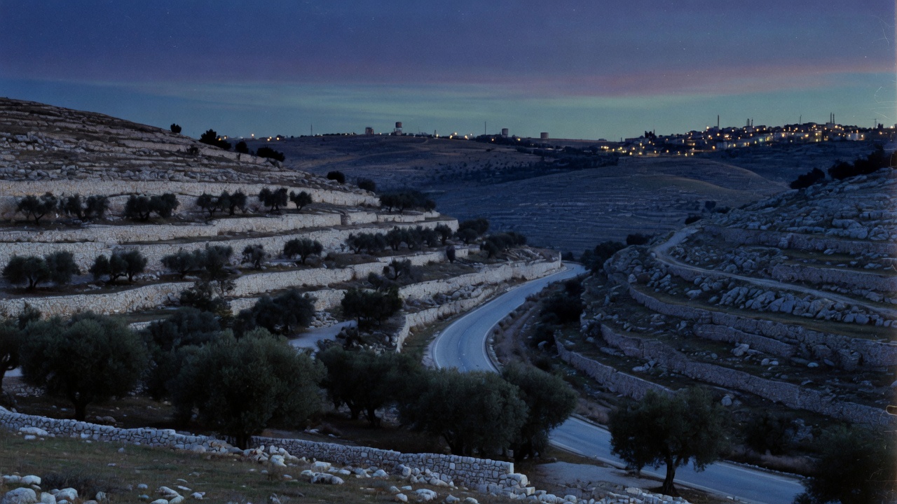
Judea is the southern highland, with its historic centre at Hebron and with Bethlehem and the Etzion bloc between Hebron and Jerusalem. Samaria is the northern highland, including Nablus, Jenin and the towns along the western edge toward Tulkarm and Qalqilya. Jerusalem lies between the two, and the Jordan Valley forms the eastern slope toward the river. The Anti-Defamation League records that the highlands have been known as Judea and Samaria since antiquity, and that the names stayed in ordinary use through the British Mandate. The CIA World Factbook, as compiled by the Jewish Virtual Library, gives a total area of about 5,860 square kilometres, including the Latrun salient and the northwest quarter of the Dead Sea, and treats East Jerusalem as a separate statistical question even when it sits on the same map.
The western edge is the 1949 Israel-Jordan armistice line, the Green Line. The ADL describes it as the demarcation drawn after the 1948 war, named for the green ink on the maps. It is not a treaty border. The Israel-Jordan General Armistice Agreement, signed at Rhodes on 3 April 1949, says so itself: no provision shall in any way prejudice the rights, claims and positions of either party in the ultimate peaceful settlement of the Palestine question, the provisions being dictated exclusively by military considerations. The demarcation lines were agreed without prejudice to future territorial settlements or boundary lines. A ceasefire line. Not an agreed international boundary. Anyone who calls it Israel’s border has to explain why the agreement that drew it says otherwise.
History in brief
Judea and Samaria are names of ancient kingdoms, and they run through the Hebrew Bible. West Bank is a mid-twentieth-century geographic coinage: the bank of the river west of the Hashemite kingdom, after Transjordan’s Arab Legion took the highlands in the 1948 war. The CIA Factbook’s etymology note says the designation refers to land Jordan held and administered after 1948, on the far side of the river from Jordan proper. CAMERA notes that the English names Judea and Samaria were in ordinary use, including by British Mandatory officials, until Jordanian rule introduced “West Bank,” and that Hebrew speakers still say Yehuda ve-Shomron every day.
On 24 April 1950 Jordan’s House of Deputies and House of Notables, in joint session, resolved to unite the two banks of the Jordan in one state. Almost nobody recognized it. The Jewish Virtual Library names Great Britain and Pakistan as the only countries that did. A Washington Institute account records the same pair, noting that some Israeli presentations have named Britain alone. King Abdullah acted over the objections of the Arab League. In nineteen years of Jordanian rule, no independent Arab state was established there.
CAMERA notes that Jews were barred from living or buying property in the Jordanian-held highlands. The older Jewish communities in Hebron, the Old City of Jerusalem and Gush Etzion had been destroyed or expelled in 1948. Israel took the area from Jordan in the June 1967 war and has administered it since. On 31 July 1988 King Hussein formally renounced Jordan’s claim and severed legal and administrative ties with the West Bank, waiving the 1950 annexation.
Many foreign governments, and Arabs in Judea and Samaria, call Israel’s presence an “occupation.” Israel describes a defensive war, disputed title after an annexation almost no one recognized, security depth, and historical ties. Ask the obvious question: taken from whom? The last ruler was Jordan, whose annexation almost no state accepted and which Jordan itself gave up.
After 1967, Israelis returned to Gush Etzion and Hebron and built new communities. Kfar Etzion, rebuilt in September 1967 on the site of a bloc destroyed in 1948, was the first. Arabs in Judea and Samaria call those communities illegal settlements. Israel disputes that reading. Their status, like borders and Jerusalem, was left to permanent-status negotiations that have not produced a treaty.
Areas under the Oslo Accords
The Israeli-Palestinian Interim Agreement, signed in Washington on 28 September 1995 and known as Oslo II, divided the highlands into three zones for a transitional period of no more than five years from the May 1994 Gaza-Jericho agreement. In Area A, mainly the large Arab cities, the Palestinian Authority has civil and internal security responsibility. In Area B it has civil responsibility and Israel has overriding security responsibility. Area C is the West Bank outside Areas A and B. There Israel kept civil and security control, with specified powers to be transferred later. Those transfers were never completed. Talks stalled after the violence that began in 2000.
The Washington Institute and the CIA compilation both put Area C at around 60 percent of the land, under Israeli civil and military control. A Jewish Virtual Library map of the interim arrangements gives Area A about 18 percent, Area B about 22 percent and Area C 60 percent. Areas A and B, roughly two-fifths of the land, hold most of the Arab urban population. Population counts vary with definitions and dates, above all whether East Jerusalem is included. The ADL has cited about 2.7 million Arabs in Judea and Samaria and about 400,000 Israeli Jews in settlements, excluding East Jerusalem. The CIA compilation dated July 2020 gave a total population of about 2.9 million and noted about 419,000 Israeli settlers in the West Bank as of 2018.
Oslo did not erase Israel’s security role. Israeli forces still enter Area A, including in raids against terrorists. And keep Gaza separate in your mind. Israel withdrew its civilians and army from the Gaza Strip in 2005. Hamas seized Gaza in 2007. Gaza is a separate coastal territory. It is not part of Judea and Samaria.
Why the name matters
Every name gets read as a side. Israeli official Hebrew uses Yehuda ve-Shomron. Most foreign ministries and newsrooms use West Bank. Arab and Jewish residents live in cities, villages, refugee camps and Israeli communities, and both peoples have historical ties that no label cancels.
The older name does not, by itself, settle borders, citizenship or the rights of the people who live there. But it does expose one thing: “West Bank” is not a neutral default that dropped from the sky. It is the term for land Jordan had just seized. Judea and Samaria is not a slogan invented after 1967. It is the ancient and Mandate-era name for the same hills.
Use either name if you must, but know which one came first. Then go to the facts: who governs which zone, who lives where, and what the signed agreements actually say.
This post is background. The evidence from the war in Gaza is in Naza: The Real Story, where senior IDF commanders and intelligence officers describe how the war against the terrorist organization Hamas was fought. It is free to watch, with English subtitles. For where that war began, read what happened on 7 October 2023.
Sources
- ADL — West Bank backgrounder adl.org
- ADL — The Green Line adl.org
- ADL — Disengagement adl.org
- Jewish Virtual Library — Israel-Jordan Armistice Agreement (3 Apr 1949) jewishvirtuallibrary.org
- Jewish Virtual Library — Jordanian annexation of the West Bank (24 Apr 1950) jewishvirtuallibrary.org
- Jewish Virtual Library — CIA: West Bank Facts and Figures jewishvirtuallibrary.org
- Jewish Virtual Library — Interim Agreement (Oslo II), 28 Sep 1995 jewishvirtuallibrary.org
- Jewish Virtual Library — Map of Palestinian Autonomy jewishvirtuallibrary.org
- Jewish Virtual Library — The History of Modern Jordan jewishvirtuallibrary.org
- Jewish Virtual Library — The Etzion Bloc (Gush Etzion) jewishvirtuallibrary.org
- Jewish Virtual Library — Judea jewishvirtuallibrary.org
- Washington Institute — Limiting Incursions in Area A washingtoninstitute.org
- Washington Institute — King Hussein’s 1988 disengagement washingtoninstitute.org
- Washington Institute — The ghost of annexation past (24 Apr 1950) washingtoninstitute.org
- CAMERA — The debate about Israeli settlements camera.org
- CAMERA — Judea and Samaria in common English use camera.org